Four Theydons, One Walk

This is another roughly circular walk going clockwise through the fields around junction 27 of the M11/M25, which again further highlights the open countryside and views over the Roding valley available to us a relatively short distance away. On this walk the noise from the motorways is never very far away, but this is easily compensated by the scenery, wildlife & villages it passes through. This walk also makes use of some very interesting old bridle ways, one of which follows the route of an old Roman road.
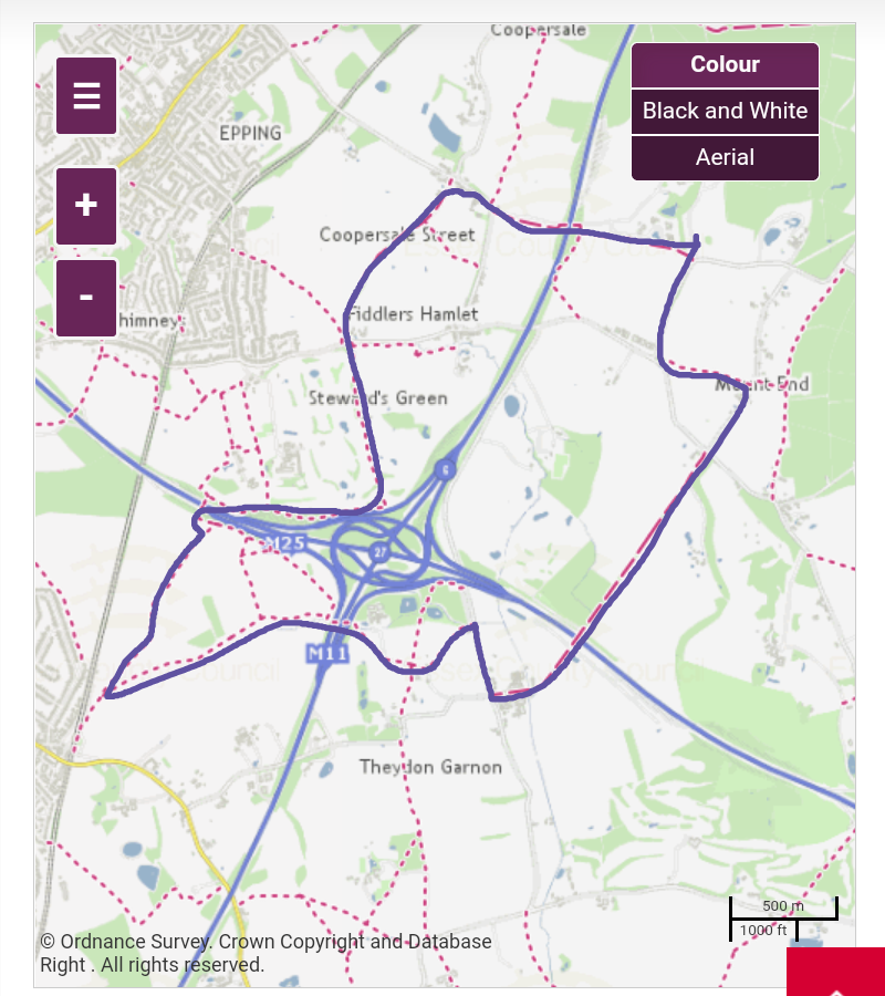
Starting at Theydon Bois I cross the footbridge just South of the station entrance and follow the footpath into the fields East of the platforms behind the station. Once inside the fields I head North East keeping the tall hedgerow to my left & once I go through the first hedgerow in the field directly behind the station I turn immediately left following the path through a gap in the tall hedge over a small wooden bridge, then turn right keeping the tall hedge to my right.
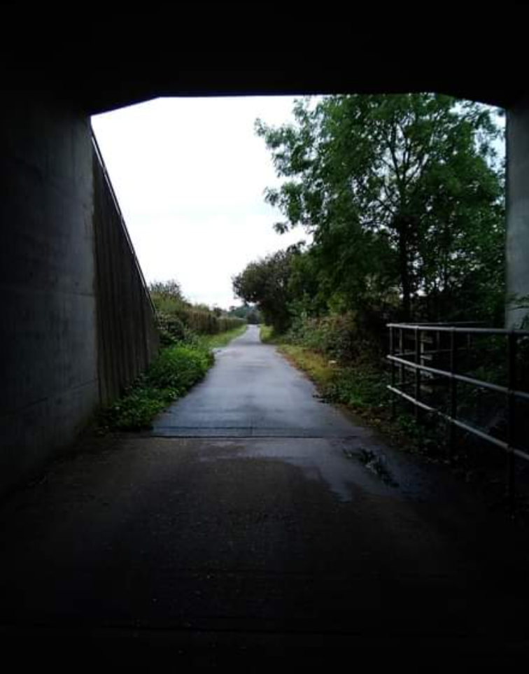
From here I go through the first hedgerow in this field then follow a drainage ditch in front of me which runs North through the centre of the field cutting it roughly in half. At the end of this ditch i reach a concrete service road along the North edge of the field where I turn left, and then right through a tunnel beneath the M25. Once through this tunnel I turn right heading East walking uphill until I reach the style entering Epping Golf Course. There are some interesting views East along the M25 from here. Once inside the golf course I keep right walking along the edge for around 500 yards until I reach a hedgerow running in a Northerly direction. I follow this hedge uphill keeping it on my right for around 250 yards until I reach a rough track heading North through the golf course.
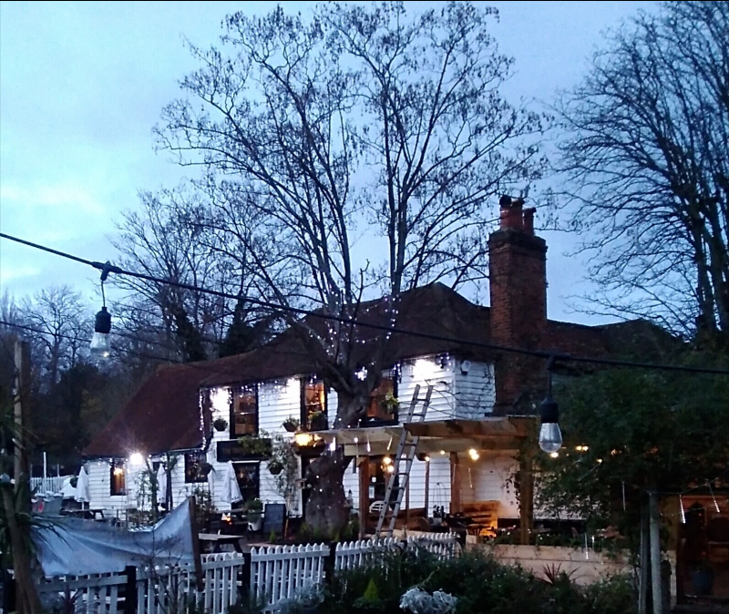
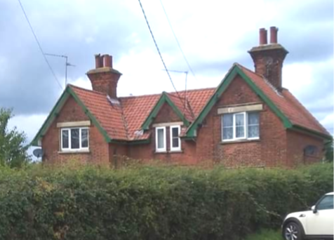
I follow this track North going past Little Thorn Hall Cottage on my right & continue North until I reach Stewards Green Road. Here I turn left then right between the two lodge houses at the entrance to Stewards Green Lane, which is a very old bridle path running North East toward Coopersale Common. I continue following this path North East until I reach Coopersale Street where I arrive at the 2nd Theydon on this walk, the Theydon Oak Pub. Ok admittedly this is a bit of a cheat, but an interesting cheat none the less as this beautiful building has origins in the 18th century and is loosely surrounded by a number of equally old & really fascinating buildings.
Here I turn right and walk East along Coopersale Street past the old Forge Cottage and Coopersale Lodge on my right, which is believed to date back to the 15th century with modern adaptions. At the bend I cross over the road to pick up the footpath immediately to the right of the entrance to the Gaynes Park Estate. From here i continue East along the edge of two fields keeping the access road into Gaynes Park to my left. At the end of this field I cross the footbridge over the M11 into another field where the footpath runs along the South boundary of the private Gaynes Park estate.
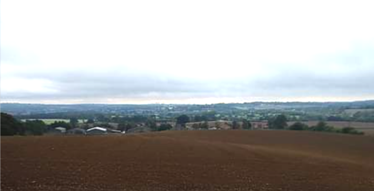
From here there are some really quite fine & wide views of the surrounding countryside and also looking South over the Roding valley. The M11 motorway carving the countryside in two has a prominent presence in these views but this is one of the highest vantage points on this walk and you can see for quite a distance from here. Continuing East I go through a gate onto Banks Lane where I turn right walking downhill to Mount Road. From the junction of Mount Road I turn left and then immediately on my left I follow a footpath through the hedge and head East through three fields on Sawkins Farm, until I reach Mount End Road. As the name suggests I am now at Theydon Mount, the 3rd Theydon on my walk. From here I turn right and walk South down to Mount Road. At the junction I cross over and take the footpath ahead of me immediately left of North Farm.
This footpath is a very interesting one and looking at it on the OS maps gives a very telling clue to its past. It’s as straight as an arrow. So perfectly straight in fact that you can hold a ruler beside it on the map & it doesn’t deviate even a millimetre left or right. This path follows the route of an old Roman road which once ran from Dunmow to London. If you look closely on the map to the south of the M25 you can see another small section of footpath following the exact same perfect line straight through Hydes Farm Lodge. Several miles further south the same Roman road runs beneath the West boundary of Claybury Park parallel with Roding Lane North, again perfectly aligned with this one. This path fascinates me, just imagine the stories it could tell. You don’t even need to know about its history to be able to see it is clearly very old because all the other clues are there too, the thick impenetrable hedgerows either side so dense they almost form a tunnel rather than an open path.
This path runs South West in a bolt straight line which is so long you cannot see the other end. After what feels much longer than it probably was I reach a small tunnel which goes beneath the M25 where the path bends to the right, bringing me to Hobbs Cross. Again there is further history at this point as a Roman lead coffin was found here & the place name ‘Hobbs’ is of Roman origin. There were a number of settlements and villas in this corner where the two motorways converge, along the route of what was once a main road into London. Outside the M25 it’s possible to track the route this road would have taken North East through the fields to Dunmow. If you look carefully enough on Google Earth you can even see the tell tale faint lines where it now lies buried beneath farmland in places.
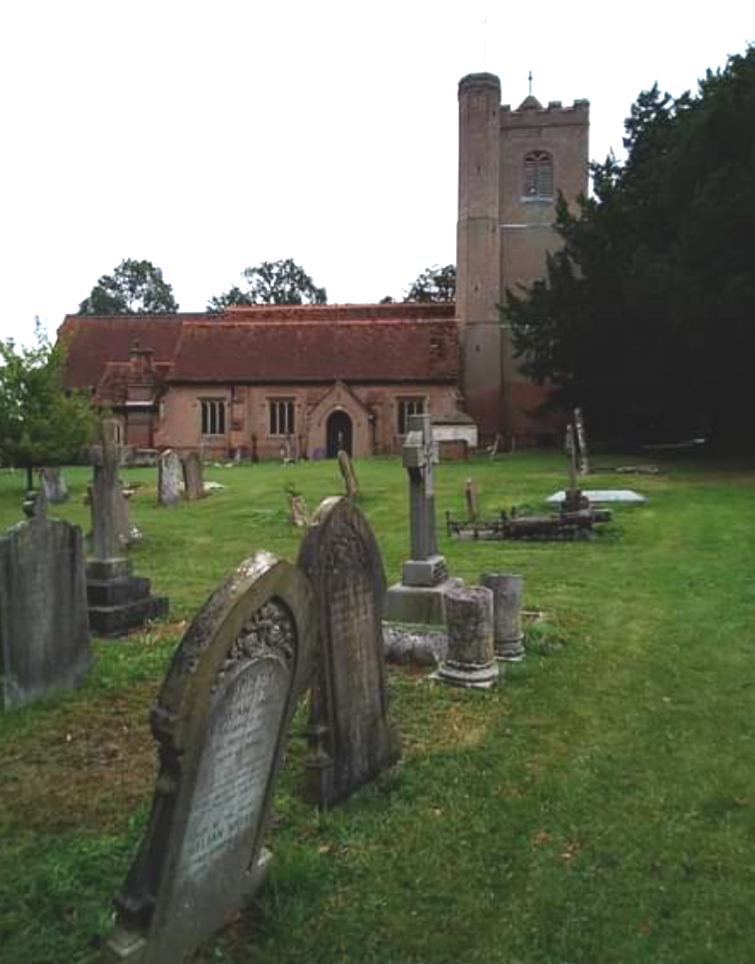
I am now at Hobbs Cross Road where I turn right heading North until I reach Dawes Bridge Cottages on my left. I walk into the driveway to pick up the footpath once again through a field heading South East, coming out beside Garnish Hall Cottages. I am now at the 4th and final Theydon on this walk, Theydon Garnon which also has a rich history & was named after the Gernon family who held the Manor here from the 13th century, Garnish Hall now stands on the site of the Manor. As I exit the footpath with the cottages to my right, directly in front of me is All Saints Church, a place of worship since the 13th century. A number of old houses survive around the church which are linked by public footpaths. Records also show there was once a workhouse in this village. Here I turn right following a farm track West leading to Garnish Hall Farm. After around 200 yards I reach a sharp right bend in the track & directly in front of me is a gate in the corner of a horses paddock which I enter.
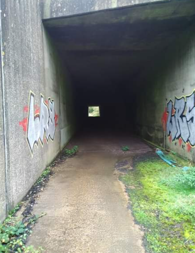
Walking diagonally across this field to the far North West corner, I go through another gate and cross a small wooden bridge over a drainage ditch. This brings me out onto a concrete service track where I turn left then go through another gate & walk West through a long tunnel below the M11. This tunnel is longer than the others and daylight doesn’t reach the middle so I have to concentrate on my footing as I can’t see the ground until I get nearer the other end. On exiting the tunnel I turn right and then I turn immediately left around a hedge, keeping the hedgerow on my left I follow a grassy path West.
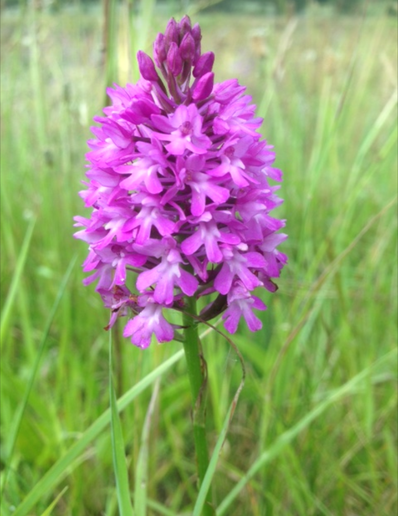
The grassland to my right in this corner of the motorway is ecologically extremely important. Although hemmed in against the junction of 2 major motorways where you would expect pollution to be a huge problem, this field is home to some of our most rare & endangered plant species. If you time it well enough around early to mid June, you may be as fortunate as I was to see the beautiful pink Pyramidal Orchids blooming here. Quite often these are found growing close to Bee Orchids which flower at the same time, so it’s well worth having a field study of your own just to see what other rare species you might find here in this very special piece of grassland. Similar endangered habitats exist on the verges around the edges of the Hastingwood interchange which are equally rich in wild Orchids in summer.
After around 300 yards keeping the hedgerow to my left I follow the path through a gap in the hedge on my left which takes me into the next field where I now walk South West across another three fields keeping the hedge line to my right, with Blunts Farm in the distance to my left until I eventually reach the original starting point on this walk in the small field directly behind Theydon Bois station. I am now back at the first and last Theydon on this walk and have found once again not only some wonderful countryside views, but through my research an incredible wealth of environmental and historical interest right on our doorstep.
The fields and grasslands circumnavigating junction 27 of two of the busiest motorways in our area may look unremarkable both on the ground and from above, but they include some of our most ecologically important sites for endangered plant species. Research also shows that these areas have proven to be unusually rich in archeological finds from many different eras including Medieval, Roman & Celtic and as far back as the Mesolithic. It also includes one of the largest and most famous treasure hoards of Iron Age coins which was found at Theydon Bois. The word Theydon was thought to have originally meant ‘The valley where thatch materiel grows’ and given the extent of the wet grasslands around the flood plains of the river Roding both sides of the M11 this would certainly make sense. Theydon Bois, Theydon Mount & Theydon Garnon were mentioned in the Doomsday Book as Taindena and Teidana. In the distant past Theydon Mount has been known as Theydon Paulyn, Theydon Lessington and also Theydon Briwes after its various lords of the Manor.
Evidence certainly shows this part of the Essex countryside has proven to be a very desirable place to settle for communities over many thousands of years and It does not take too long to start uncovering this evidence with a bit of research. When i set out on this walk I expected the landscape to be very different to the uplands scenery I am more used to, but I did not expect it to have such a rich history or to contain the precious habitats I have discovered. I am really quite happy I decided to look a little deeper into Theydon as I now have a very different appreciation for it. I have barely even scratched the surface here but from what my research has shown me I no longer feel this location is just an odd place name at the end of the Central Line, it is clearly very much more special than that.
Coopersale Fiddlers hamlet Theydon Theydon bois Theydon garnon Theydon oak
