Harlow To Woodford

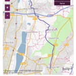
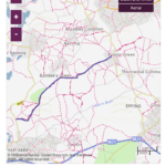
This is one one of the longest walks & also one of my favourite. It has a very personal feel to me because the walk starts on the edge of the fields I played in as a child next to the water tower on Rye Hill Road on the outskirts of Harlow. This walk will take me along some of the most ancient byways on the whole of the Epping Uplands which have been used to travel between communities for many hundreds of years.
I arrived in Harlow just before 9am on what was going to be a hot summer day. As i walk through the estate where I grew up I actually feel nervous as I approach my old house. As I walk through the alley below a tiny block of flats which once seemed huge, there in front of me is my childhood home. I always tingle with excitement of all the memories I have of living here, the tree I climbed behind the house still recognisable and as I look up at the back of the house to my surprise I notice the rusty old brackets on the roof my father used to fit his CB Ariel with almost 40 years ago.
Starting from outside my childhood home I walked across the road into the small wooded area where we once built camps & hid from eachother. This always seemed like a forest to us but in reality was just a fairly small plantation & took no time at all to walk from one end to the other.
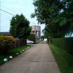
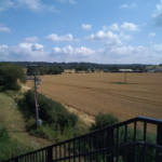
I exit these woods directly opposite the bottom of Rye Hill Road and walk east along the road past the entrance to Parndon Wood, Rye Hill Common is to my left. As I approach the first of several ancient byways I will be using on this walk, I see the water tower ahead of me & remember as children how we used to tell each other it was haunted, and the winter in the early 1980’s when it snowed heavier than we had ever seen before and Rye Hill was blocked with huge snowdrifts which we built igloos in. Just past the water tower on the right is the bridle path I’m looking for.
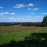
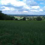
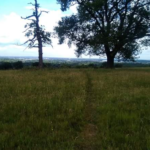
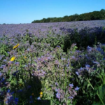
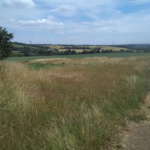
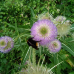
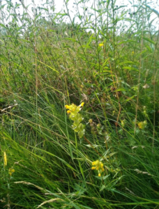
I head south along this first track which goes from Rye Hill to Sumners farm. Tall hedgerows line the path which are a mass of activity with bees and butterflies. It’s really going to be a hot day & even this early I can feel it. To my left the first of two wildflower meadows full of tall grasses & ox eye daisies with an undercarpet of parasitic Yellow Rattle. I stop to take a picture. Further along another meadow with a single Oak tree casting a welcome shade with it’s low spreading branches. I stop for some water as the heat is really starting to build.
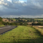
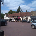
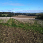
Passing Sumners Farm I reach the end of this pathway onto Epping Road where i walk along the front of a tiny terrace of farm cottages & to my right catch my first glimpse of the Stort Valley in the far distance behind the cornfields. Epping Green Chapel and the village pond are at the end of these cottages, where I cross the road to the travelers friend pub beside which is the next ancient path I will follow. Epping Long Green.
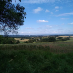
This is a longer bridleway with high hedges either side and a couple of isolated farm houses on the left as I head south, where the path drops into a small dip then goes round the edge of Copy Wood at the top of Nazeing Common. As I continue south I reach Harolds Park Farm where some of the most breathtaking views across the uplands and the Lea Valley open up. From up here I can see for miles. In one direction I can see the forest & the distant buildings in the city, in the other the rolling open countryside and hills of the Lea Valley and Upper Stort valley.
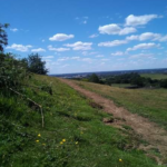
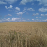
Continuing south from here I get another last view across the beautiful Stort Valley as I join the next track, Galley Hill Green which takes me south through the summit of Galley Hill Woods to the tiny hamlet of Aimes Green. Along this path just before entering the woods to my right an opening onto the hillside gives the most stunning view across the Lea Valley as the landscape plummets for what looks like miles into a vast bowl shape below. Endless cornfields in the distance glowing with ripened corn. I always stop here for lunch and think how amazing it would be to wake up to this view every day.
I continue south from here downhill through Galley Hill Woods, eventually reaching Aimes Green where I pick up yet another ancient byway Claygate Lane, described as a remarkable survivor of it’s kind, some of these pathways were in use as far back as the 12th century. This pathway sweeps downhill clinging to the side of Kennel Wood Hill. Through gaps in the hedgerows lining this path you can see the forest one side & the vast Lea Valley the other. At one point in the distance you can just see the Queen Boudicca Obleisk on a hill top beside a lonely Oak tree in Upshire. Stepping out onto the summit of Kennel Wood Hill I am met with stunning views to the south across the southern Lea and Thames valleys. The views here are simply unbeatable.
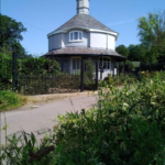
I go back onto the bridle path and follow as it winds downhill coming out directly beside Eagle Lodge, the instantly recognisable round cottage on the Crooked Mile & gatehouse to Monkham Hall up a small track just behind it. From here I cross the road into the cornmill meadows feeling as if I am leaving ancient history behind me. Continuing south through the cornmill meadows the heat feels even more intense as I reach the walled gardens of Waltham Abbey, in the market Square I pass the Welsh Harp with it’s bowed roof & Sun Street looking like the cobbled street of an old seaside town. As I leave Sun Street I turn right heading towards the M25 bridge, immediately over the motorway bridge a path slopes downwards to my left leading to a small housing estate through which I walk down an alleyway that takes me onto the fields alongside Dowding Way.
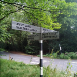
I find a footbridge in the fields that seems in the middle of nowhere which takes me over Dowding Way to Avey Lane farm, I briefly sit on the steps in the shade of a bank of brambles to escape the heat before I cross here. The path now goes through the centre of Avey Lane farm heading East and eventually out through a gap in the hedge onto Pynest Green Lane where I turn right walking past High Beech stables, then left onto Hangmans Hill. Directly opposite the junction with Avey Lane and Hangman’s Hill is another very special footpath, Thompson’s Lane.
Crossing the road and entering this path is always exciting after walking all this distance because I know exactly what is at the top. This is a little steep and often muddy but when I reach the top, to my right there are wide sweeping views across West Essex & South Hertfordshire. In the distance I can see the hills beyond Waltham Abbey which I walked along from Harlow today. It always fills me with an enormous sense of achievement seeing how far away those hills are that I traversed only a couple of hours ago. Reluctantly leaving those views behind me the path goes south into a dip & then back up, on the other side of which looking South and West are amazing panoramic views over North London and the Southern Lea Valley. This is one of the best local places for views like these and the western slopes of the forest never fail to please with good vantage points.
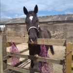
The path now goes past a large manor style house on my left before bending right and coming out onto Mott Street. From here I have a choice. I can go left and walk uphill then take another old bridle path on the right which links High Beach to Lippitts Hill – Pepper Alley, or I can go right then immediately left and walk through a paddock where two of the friendliest horses I have ever met live. I choose right every time. Both pathways meet up at the same point at the summit of Aldergrove wood where they merge together into another track called Arthur’s Lane.
I go through the paddock and after saying hello to the horses and giving them the fuss they always seem to love, I walk uphill to Aldergrove. This is the last of the steep climbs on this route and always feels hard work after walking so far. At the top I now follow Arthurs Lane south which comes out at Lippits Hill just west of the mobile home park, then walk around the bend past the Owl pub and continue past Lippitts Hill Lodge & Catacombs Corner opposite which I enter Fairmead and walk the width of the plain towards Epping New Road.
Once I get close to the new road I walk parallel to the road due south, crossing the top of Rangers Road and continue until I eventually reach the long plain at the rear of the Warren Wood Pub. This is where I stop to take a few last pictures and finish the last of my food before leaving the forest here and taking the roads back to Woodford. This is a long route but always leaves me feeling an enormous sense of achievement to complete.
Bridle path Epping Forest Epping Forest walks Footpath Harlow Uplands walking Woodford
